Glendale's desert landscape hides more than caliche. Beneath the surface, ancient Salt River channels and perched groundwater pockets create sharp resistivity contrasts that can fool a standard investigation. When you only drill at grid points, you miss what's between them. Electrical resistivity imaging fills those gaps. We run Vertical Electrical Sounding (VES) arrays that penetrate 30 to 100 feet deep. The data shows where saturated silts transition to dry sands. It flags low-resistivity zones that might indicate clay lenses or contaminated plumes. For Glendale projects near the New River or Luke AFB, understanding subsurface continuity matters. A CPT test gives you point data. VES gives you the cross-section. Combined, they reduce the risk of excavation surprises on commercial pads and utility corridors.
A single VES sounding replaces half a dozen test pits when you're mapping depth to groundwater across a 5-acre parcel.
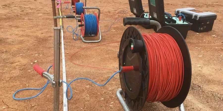
Our approach and scope
Local considerations
Glendale sits at 1,152 feet elevation on basin-fill deposits that hide erratic caliche layers. Caliche can read as high-resistivity rock on a VES profile. Misinterpret that as competent bearing material, and your excavator hits cemented hardpan it can't break. The opposite problem happens with saturated silts that mimic clay on resistivity alone. Without a borehole tie-point, you might over-excavate or under-design a footing. Seasonal groundwater rise in the West Valley compounds this risk. A site surveyed in June could show dry conditions. By August, monsoon recharge lifts the water table three feet. We address this by running reciprocal soundings and correlating resistivity with local well data from ADWR records. The VES survey becomes not just a snapshot, but a calibrated dataset tied to hydrogeologic reality.
Watch the video
Reference standards
ASTM D6431-18 – Standard Guide for Using the Direct Current Resistivity Method for Subsurface Site Characterization, ASTM D2487 – Standard Practice for Classification of Soils for Engineering Purposes (Unified Soil Classification System), IBC 2021 – Section 1803 Geotechnical Investigations (adopted by City of Glendale)
Related services
2D Electrical Resistivity Tomography (ERT)
Multi-electrode lines for continuous cross-sections. Ideal for pipeline alignments, landfill boundary delineation, and mapping lateral changes in basin fill across Glendale's alluvial fans.
1D Vertical Electrical Sounding (VES) with Borehole Calibration
Point soundings tied to existing logs or test pits. We invert the apparent resistivity curve to layer thickness and true resistivity, delivering depth-to-groundwater and bedrock depth estimates for foundation design.
Typical parameters
Common questions
What's the typical cost range for a VES survey on a Glendale commercial lot?
For a standard commercial lot investigation involving 3 to 5 Schlumberger soundings with 2D inversion and a summary report, projects typically run between US$670 and US$1,110. The final figure depends on electrode spread length, access constraints, and whether we're correlating results with existing borehole data. We can provide a fixed-price proposal within 24 hours of a site walk.
How deep can electrical resistivity testing reach in Glendale's basin soils?
With a Schlumberger array, we routinely investigate to 100 feet when site dimensions allow sufficient electrode separation. Depth of investigation is roughly one-fifth the total spread length. Glendale's basin-fill deposits—mostly sands, silts, and gravels—transmit current well, which helps penetration. In areas with thick near-surface caliche, we increase injection current to overcome the high contact resistance.
Can VES distinguish between dry sand and caliche?
Both can show high resistivity, which creates ambiguity. Dry sand might read 150 ohm-m; caliche can exceed 300 ohm-m. The distinction comes from the sounding curve shape and layer thickness patterns. Caliche typically appears as a thin, sharply bounded resistive cap over conductive material. We cross-reference every VES interpretation with at least one physical sample—a test pit log or borehole—to break the equivalence and confirm the material type.
How long does a VES field survey take on site?
A crew of two technicians can complete four to six Schlumberger soundings in a single field day on a typical Glendale lot. Setup time per sounding runs 20 to 30 minutes, with acquisition taking another 15 to 20 minutes depending on spread length and stacking requirements. We deliver inverted profiles and a draft interpretation within three business days of field completion.