In Glendale, we often see plans stall because the subsurface investigation didn't account for the desert's hidden cementation. A standard driller's log looks fine until you hit a caliche layer at eight feet that sends the sampler bouncing, and suddenly the blow count data needs interpretation, not just recording. Our team runs SPT boreholes across the Salt River Valley terraces and the dissected piedmonts west of the Loop 303, correlating N-values with the Unified Soil Classification under ASTM D2487. We've logged enough Basin and Range alluvium to know when a refusal on sandstone-like calcrete is a drilling artifact versus a genuine dense layer that governs bearing capacity. The CPT test can help when we need continuous tip resistance through those cemented horizons, but the SPT remains essential for sample recovery in gravelly facies where a cone would deflect. For sites near the New River alignment, where floods have reworked the near-surface, we often pair the SPT with test pits to visually log cross-bedding that a split spoon alone can't capture.
Caliche in Glendale isn't a single layer, it's a process: the SPT records where cementation starts, but experience tells you where it will govern the foundation design.
Our approach and scope
Local considerations
The IBC references ASCE 7 for seismic design, and Glendale sits within a region where the nearest Holocene fault traces run through the Phoenix Mountains to the east. The basin geometry amplifies long-period motion, so a generic site class assumption is not conservative. Without SPT data down to 100 feet or refusal, you cannot reliably assign Site Class C, D, or E, and that choice shifts the design spectral acceleration by 20 to 40 percent. We have seen projects near the Cardinals stadium area where near-surface blow counts suggested stiff soil, but deeper boreholes revealed a softer layer within the basin fill that changed the site period. Liquefaction is not the primary hazard here because the groundwater is deep in most of Glendale, but the liquefaction assessment becomes mandatory if the site lies within the floodplain of the Agua Fria where perched water can saturate silty lenses. The other risk is structural: limestone-like calcrete layers that refuse the sampler can be mistaken for bedrock, leading to an undersized footing that punches through when the underlying softer material consolidates under load.
Reference standards
ASTM D1586-18: Standard Test Method for Standard Penetration Test (SPT) and Split-Barrel Sampling of Soils, ASTM D2487-17: Standard Practice for Classification of Soils for Engineering Purposes (Unified Soil Classification System), ASCE 7-22: Minimum Design Loads and Associated Criteria for Buildings and Other Structures (Seismic Site Class determination), IBC 2021: International Building Code, Chapter 18 (Soils and Foundations)
Related services
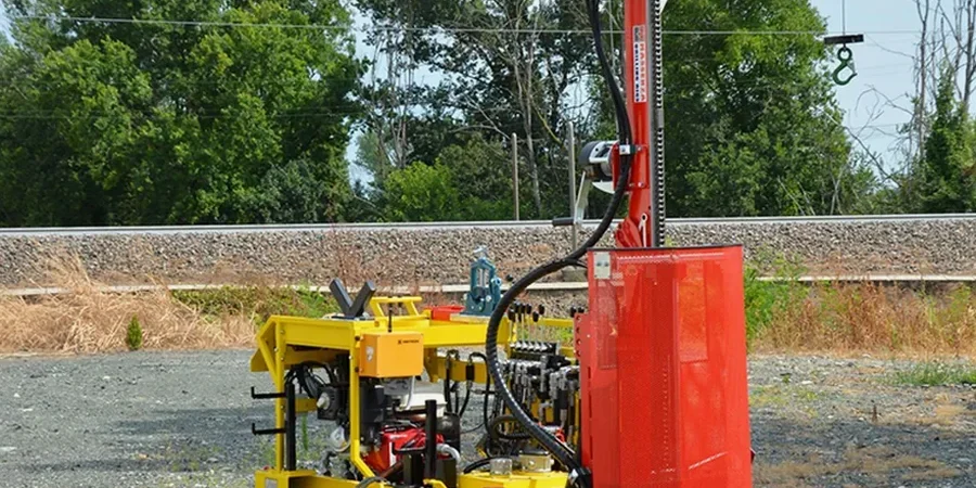
Drilling and SPT Execution
Truck-mounted rig penetrating basin alluvium with hollow-stem augers or mud rotary through caliche. We log every run, photograph samples, and correct N-values using hammer energy calibration records from our equipment.
Geotechnical Lab Testing Package
Companion classification suite including sieve analysis, Atterberg limits, and moisture content on SPT samples. When cementation is suspected, we add carbonate content testing to quantify the caliche bonding and inform excavation difficulty.
Typical parameters
Common questions
What depth do you typically drill for an SPT investigation in Glendale?
For standard residential or light commercial work we target 30 to 40 feet, which captures the active zone and the upper basin fill. For taller structures or sites where the seismic site class must be confirmed, we extend to 80 or 100 feet, provided caliche stringers do not cause early refusal. The depth ultimately depends on the foundation type and the structural engineer's requirements per IBC.
How does the caliche layer affect the SPT results?
Caliche, which is a pedogenic calcium carbonate accumulation common across Glendale's desert soils, can produce artificially high blow counts because the sampler hits a cemented crust that fractures rather than penetrates. We log the presence of caliche, note any sampler damage, and interpret whether the high N-value represents a continuous cemented stratum or just a nodular zone. This distinction is critical for excavation planning and foundation bearing capacity.
What is the cost of an SPT investigation in Glendale?
A typical SPT drilling program in Glendale runs between US$550 and US$660 per borehole for standard depths, including the rig, crew, sampler recovery, and field logging. The total project cost depends on the number of boreholes, depth per hole, and whether companion lab testing or geophysical surveys are added to the scope.
Which ASTM standard governs the SPT procedure?
The test is performed in accordance with ASTM D1586, which specifies the split-spoon sampler dimensions, the 140-pound hammer with a 30-inch drop, and the blow count recording method. We supplement this with ASTM D2487 for the visual classification of the recovered samples in the field.
Can the SPT data be used alone for foundation design in Glendale's basin fill?
The SPT data provides the core information layer through N-value profiles and sample classification, but for sites with deep groundwater, thick gravel, or seismic sensitivity, we recommend complementing it with shear wave velocity measurements or CPT soundings. The combination yields a more complete picture of the subsurface, especially where caliche complicates the blow count interpretation.